Porcupine Hill - Sat, Jun 3 2017
 Print-Friendly Version
PRE-REGISTRATION REQUIRED:Once you've reviewed the event details, and decided you'd like to join us, you MUST sign up at the bottom of this page.
| The Basics: | |||||||
| Event Type: | Hike | ||||||
| Event Location: | Highway 22 south of Longview | ||||||
| Date(s) & Time: | Sat, Jun 3 2017 11:30 AM (Carpool Departure: 10:00 AM *log in for location*) | ||||||
| Registration Cut Off: | Sat, Jun 3 2017 9:00:00 AM | ||||||
| Event Duration: | 7 hours driving/hiking so arrive back to carpool at 5 PM | ||||||
| Difficulty Rating: | D3: Moderate | ||||||
| Event Coordinator(s): |
Geoff Chiddell
You must be logged in to get the Event Coordinator contact information. | ||||||
| Participant Info: | |||||||
| Who's Invited: | Members & Guests, 21 And Older Only | ||||||
| Maximum Group Size: | 12 | ||||||
| Maximum No. Guests: | 4 | ||||||
| Minimum Group Size: | 4 | ||||||
| Maximum No. Guests Per Member: | 2 | ||||||
| Number Registered So Far: | 9 (To see who's signed up, log in to the Member Area) | ||||||
| Are Dogs Permitted: | No | ||||||
| Itinerary: | |||||||
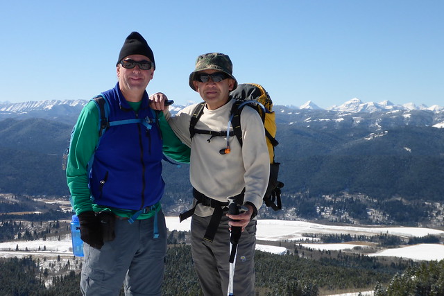
| The Porcupine Hills are located to the east of Highway 22. One particular hill is near that road's high point. To see it we'll do a 5 km loop with steep upward slopes to gain 300 vertical meters, a ridge crest and a more gentle downward slope. We will hike up a unofficial trail through pine forests to some spectacular sandstone rock outcroppings and admire a vista of the Rockies that extends all the way to the US border and to Crowsnest Mountain. The wild-flowers should be at their peak blossoming. Our time frame permits an early lunch, lots of rest stops and photography. | |||||||
| |||||||
| How to Get There: | |||||||
| Event Directions: | Go onto Macleod Trail South from Anderson LRT Go 73 km south on Highway 2 (Macleod) southbound Turn right on Highway 533 near Nanton, then right Go 38 km west-southwest on Highway 533 Turn left / southbound onto Highway 22 Go about 21 km south on Highway 22 Pull off the right (west side of) highway into a pullout near a landmark: a tall communications tower to the West (Right) side of the highway. Another landmark is a flat-top ridge on the East (Left) side of the trailhead parking. Note; if taking a different route than described: The trailhead pullout is 60 km south of the Longview Info Center via Highway 22. | ||||||
| Carpool to Event Distance (round trip): | 265Km | ||||||
| Carpool Departure Time: | 10:00 AM | ||||||
| Carpool Location: | Log in for location | ||||||
| Carpool Directions: |
Log in for directions
** Calgary Transit Info | ||||||
| Carpool Cost: | Approximate vehicle expense for this event is $84.80 (calculated at total Km * $0.32, effective Friday, May 9, 2025). This is based on $0.16/Km for maintenance, plus current gas price divide by 9. Alternately your carpool driver may choose to split the maintenance cost plus the actual gas cost among all in the vehicle. Your carpool driver will confirm exactly how much money they require to cover costs. Please split the actual cost among all people in the vehicle. | ||||||
| Notes: | |||||||
 - Details of this event are subject to undergo a change at any point in time, with or without warning. | |||||||
Cancellation/Partial Attendance: Please review our Cancellation Policy carefully! | |||||||